


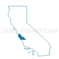
Voting District 40985, Monterey County, California
About
Outline

Summary
| Unique Area Identifier | 535314 |
| Name | Voting District 40985 |
| County | Monterey County |
| State | California |
| Area (square miles) | 9.26 |
| Land Area (square miles) | 8.88 |
| Water Area (square miles) | 0.38 |
| % of Land Area | 95.93 |
| % of Water Area | 4.07 |
| Latitude of the Internal Point | 36.70935360 |
| Longtitude of the Internal Point | -121.77168800 |
Maps


Graphs
Select a template below for downloading or customizing gragh for Voting District 40985, Monterey County, California


Neighbors
Neighoring Voting District (by Name) Neighboring Voting District on the Map
- Voting District 20245, Monterey County, CA
- Voting District 20265, Monterey County, CA
- Voting District 40965, Monterey County, CA
- Voting District 40980, Monterey County, CA
- Voting District 41005, Monterey County, CA
- Voting District 41010, Monterey County, CA
- Voting District 41025, Monterey County, CA
- Voting District 41030, Monterey County, CA
- Voting District 41095, Monterey County, CA
- Voting District OCEAN, Monterey County, CA
Top 10 Neighboring County Subdivision (by Population) Neighboring County Subdivision on the Map
- Salinas CCD, Monterey County, CA (163,203)
- Seaside-Monterey CCD, Monterey County, CA (107,513)
- Castroville CCD, Monterey County, CA (18,722)
Top 10 Neighboring Place (by Population) Neighboring Place on the Map
Top 10 Neighboring Elementary School District (by Population) Neighboring Elementary School District on the Map
Top 10 Neighboring Secondary School District (by Population) Neighboring Secondary School District on the Map
Top 10 Neighboring Unified School District (by Population) Neighboring Unified School District on the Map
- Monterey Peninsula Unified School District, CA (87,070)
- North Monterey County Unified School District, CA (26,701)
- School District Not Defined (Water), CA (0)
Top 10 Neighboring State Legislative District Lower Chamber (by Population) Neighboring State Legislative District Lower Chamber on the Map
Top 10 Neighboring State Legislative District Upper Chamber (by Population) Neighboring State Legislative District Upper Chamber on the Map
Top 10 Neighboring 111th Congressional District (by Population) Neighboring 111th Congressional District on the Map
Top 10 Neighboring Census Tract (by Population) Neighboring Census Tract on the Map
- Census Tract 106.06, Monterey County, CA (6,299)
- Census Tract 143.02, Monterey County, CA (4,024)
- Census Tract 143.01, Monterey County, CA (3,602)
- Census Tract 141.02, Monterey County, CA (2,259)
- Census Tract 103.06, Monterey County, CA (1,250)